Gulbarga District
Gulbarga District |
|
About: |
|
|
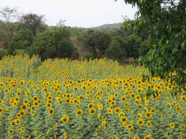
GULBARGA was known as 'KALBURGI' in former days which means stony land inKannada.Gulbarga district is situated in the northern part of Karnataka State. In the earlier days, Gulbarga was a district of Hyderabad Karnataka area and became a part of Karnataka State after re-organization of states. The Gulbarga district is situated in the northeastern part of Karnataka. Spread over an area of 16224 sq. km. the district is geographically located between 17°19'60 North latitude and 76°49`60 East longitude. Situated entirely on the Deccan Plateau, it is positioned at a height of 300 to 750 meters above mean sea level. Gulbarga is strategically located 613 km. from Bangalore, the state capital and is well connected by road to important cities like Bijapur, Hyderabad and Bidar. The Krishna and the Bhima are the main rivers flowing through the district. Gulbarga is one of the 27 administrative districts of Karnataka located on the northern side of the state. The entire district is situated in Deccan Plateau and the general elevation ranges from 300 to 750 meters above mean sea level. Two main rivers, Krishna and Bhima, flow in the district. Gulbarga district was a part of Hyderabad state during Nizam's rule and later became part of Mysore state and subsequently came under Karnataka state in 1973. Gulbarga is an industrially backward district, but presently showing signs of growth in the cement, textile, leather and chemical industries. It is also very important from tourism point of view. The widely visited place in the district is the Gulbarga Fort. The district has a dry climate with an annual rainfall of about 750 mm. The district is dominantly agrarian supported by few industries. The main soil found in the district is black soil, which facilitates the cultivation of crops like jowar, groundnut, rice, sugarcane,sunflower, wheat, cotton, linseed and pulses. The Upper Krishna Project in the district is a major irrigational venture. Some of the major industries in the region are textile, leather and chemical industries. It has following talukas.
|
|
Location info: |
|
| Gulbarga is 613 Km north of Bangalore and well connected by road to Bijapur , Hyderabad and Bidar | |
Climate/Weather of Gulbarga District: |
|
| The climate of the district is generally dry and healthy with temperature ranging from 20°c in the winter to 40°c in the summer, and an annual rainfall of about 750 mm. | |
History of Gulbarga District: |
|
|
Recorded history of this district dates back to the 6th Century A.D. The Rashtrakutas gained control over the area but the Chalukyas regained their domain within a short period and regained supreme for over two hundred years. The Kalahari's who succeeded them ruled till the 12th Century AD. Around the close of the 12th century. The Yadavas of Devagiri and the Hoysalas of Dwarasamadra destroyed the supremacy of the Chalukyas and kalachuris. About the same period the kakatiya kings of Wrangle came into prominence and the present Gulbarga and Raichur districts formed part of their domain . The Kakatiya power was subdued in 1321 AD and the entire Deccan including the district of Gulbarga passed under the control of the Muslim Emperors of Delhi. The revolt of the Muslim officers appointed from Delhi resulted in founding of ,the Bahmani kingdom in 1347 AD, by Hassan Gangu who chose Gulbarga to be his capital. When the Bahmani dynasty came to an end, the kingdom broke up into five independent Sultanates and the present Gulbarga district came partly under Bidar and partly under Bijapur. With the conquest of the Deccan by Aurangezeb in the 17th century, Gulbarga passed back to the Mughal Empire. In the early part of the 18th century when Mughal Empire was declining Asaf Jha a general of Aurangzeb became independent and formed the Hyderabad State in which a major part of Gulbarga area was also included .In 1948 Hyderabad state became a part of Indian Union and in 1956, excluding two talukas which were annexed to Andhra Pradesh the remaining talukus of Gulbarga district became part of New Mysore State. |
|
Educational Institutions of Gulbarga District: |
|
|
Engineering Colleges in Gulbarga
Medical & Health Science Colleges in Gulbarga
Other Institutions
|
|
Langauge |
|
| The prominent language spoken is Kannada,Hindi,English.Other languages like Marathi, Urdu,Telugu and Gujarati are also spoken by small portion of population. | |
Culture of Gulbarga District: |
|
|
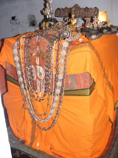
The annual Urs festival, held at the tomb of Khwaja Bande Nawaz to commemorate his death anniversary, is an important festival of Gulbarga. Thousands of pilgrims throng Gulbarga during the Urs festival. The annual festivals in the temples of Gulbarga district are usually held in January and are a major draw. The `footwear procession,` held once in three years on the previous day of Sankranti, attracts thousands of devotees from far a near to the temples of Gulbarga district. |
|
How to reach Gulbarga District? |
|
|
Nearest Railway Station:Gulbarga is an important station on the Central Southern Railway line. There are daily trains from Bangalore, Mumbai, Delhi and Hyderabad to this city. Trains and Railway Stations
|
|
| Nearest Airport:Hyderabad Airport is the Nearest Airport to Gulbarga City (225kms) | |
|
Road Transport:There are frequent buses from Bangalore and Hyderabad to this city. Bangalore and Hyderabad are 610 kms and 225 kms away from Gulbarga respectively.
Bus Stations
|
|
Tourist Attraction |
|
|
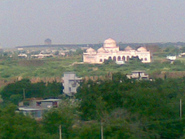
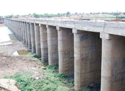
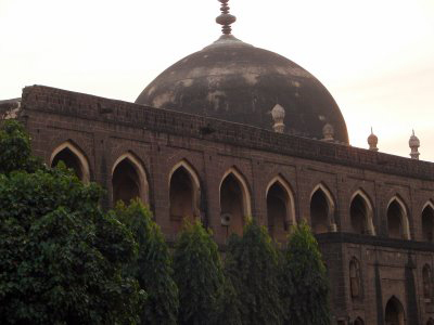
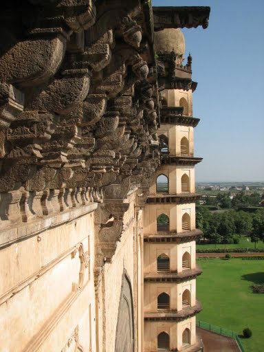
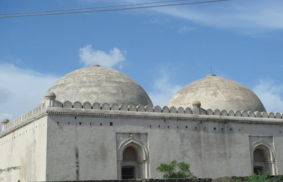
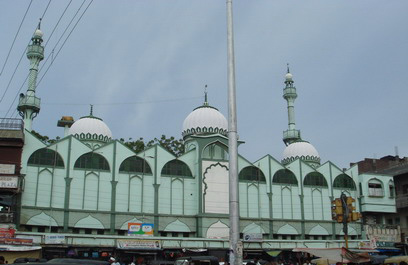
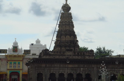
The Gulbarga Fort:Originally built by Raja Gulchand, it was later strengthened by Ala-ud-din Bahmani. The fort contained 15 towers and 26 guns of which one was 8 metres long. with in the ramparts of the fort, there is an imposing mosque, which resembles the great mosque of Cordona in spain.Several tombs of the Bahmani Sultans can be found in the eastern outskirts of the town. Gangapur:A noted pilgrim centre. The river Bhima and Awarja unite here, and pilgrims visit this place, throughout the year for a holy dip. Shorapur :Formerly known as Surapura, this is the place where Raja Venkatappa Naik, rebelled against the british in 1857. The temple dedicated to lord Krishna under the name Gopalaswamy is an object of considerable religious importance. Isampur:Located in the Hunsgi and Baichbal valleys of peninsular India, Isampur is a remote village in Shorapur taluk of Gulbarga District. The quarry site at the village is the oldest known Stone Age site in India, which is dated over a million years. Isampur is one among the Acheulian sites of the Lower Paleolithic stage and records an early appearance of hominids in India Gulbarga Jain Temples are situated in the great ancient Jain city called Gulbarga in Karnataka. At present there is only one Digambar temple at Mahavir Chowk and one Shwetambar temple in Kirana Bazaar. Both temples are devoted to Bhagvan Mahavir. Haft Gumbaz or Seven Domes is a mausoleum of the Bahmani Dynasty and is located in Gulbarga, Karnataka. Situated on the eastern outskirts of Gulbarga, this magnificent tomb extends from east to west. Tomb of Firoz Shah Bahmani:It has extended walls and 6 arch-shaped entrances, two on the north and south sides and one in the east and west sides. The upper parts are decorated openwork windowsThis is one of the imposing tombs of Bahmani Kings in the town. Built around 1422, this fine mausoleum is a Tughlaq style rectangular building with two domes. Tomb of Giyath al-Din:This tomb of the 6th Sultan of the Bahmani Dynasty is one of the finest royal tombs situated to the southern entrance of Gulbarga Fort. This tomb is much more imposing than the tombs of the other sultans. Built on a low basement, this domed fort has fortification on the east and small towers at the four corners of the roof. The Jama Masjid:Situated within the fort walls, it has stilted domes and narrow entrances typical of the Persian style of architecture. The Shrine of Saint Sharana Basaveshwara:The shrine of an eminent Hindu religious teacher and philosopher who preached religious and social equality. This temple has been developed into a pilgrim centre. The annual fair, lasting for a fortnight, is held during the month of May. Chandrakala Parameshwari Temple is a 1,200 year old temple situated at Hongunta in Shahabad Taluk of Gulbarga District. This ancient temple was built by the Chalukyas who ruled the region. The presiding deity of the temple is goddess Shakti, also called as Chandrakala Parameshwari.People throughout the country come here to pay their obeisance to Goddess Chandrakala Parameshwari. Chinmalli Mallikarjuna Temple is a delightful shrine situated at Chinmalli, about 50 km from Gulbarga, in Karnataka. This 12th century shrine is nestled on the banks of Bhima River.Chinmalli Mallikarjuna Temple enshrines Lord Shiva as the presiding deity. A beautiful Shivling is installed in the sanctum sanctorum of the temple. The temple has a beautiful octagon hall. Narayanapura Dam:Nestled amidst beautiful gardens, Narayanapura Dam is a composite dam constructed at Narayanpur in Surpur taluk, about 120 km from Gulbarga. This is a marvelous engineering structure built across the Krishna River. Shah Bazar Masjid:This is the earliest Bahmani mosque built around 1367 under the reign of Muhammad Shah. It is in the northern side of the Gulbarga Fort. It is a replica of the great mosques in the complex in Delhi. The main gate in the east features an imposing dome. Other places of interest within the town are the imposing tombs of the Bahamani rulers, the Haft Gumbaz, the tomb of Khwaja Bande Nawaz (an important local Muslim saint) and the Sharana Basaveshwara temple. PLACES AROUND GULBARGA
|
|
Hotels/Lodge/Accommodation nearby Gulbarga District: |
|
|
|
Links |
|
| http://www.gulbarga.nic.in/ | |
Gulbarga District Major Attraction |
| Gulbarga Archeology |
| The first to establish Islamic rule in the Deccan plateau was the Bahmini dynasty. Gulbarga was it's capital in 1347 but later shifted to Bidar. Many structures other than the fort still exist. These are tombs and mosques but the palace has been destroyed.....more |
| Gulbarga Historical |
| The small town of Gulbarga is famous for its association with the erstwhile medieval kingdom of Bahamani (1347-1526). It was the capital of the Bahamani rulers from 1347 to 1428.....more |
| Bhima River |
| The Bhima River originates in Bhimashankar hills near Karjat on the western side of Western Ghats, known as Sahyadri, in Maharashtra state in India. Bhima flows southeast for 725 km through Maharashtra, Karnataka, Andhra Pradesh states.....more |
SELECT YOUR HOLIDAY DESTINATION
-
Aero Sports in Karnataka
-
Archaeology in Karnataka
-
Beaches in Karnataka
-
Bird Sanctuaries in Karnataka
-
Bouldering Spot in Karnataka
-
Camping in Karnataka
-
Cave Explorations in Karnataka
-
Culturals Place in Karnataka
-
Dams in Karnataka
-
Districts Of Karnataka
-
Fairs in Karnataka
-
Festivals in Karnataka
-
Go-Karting in Karnataka
-
Hill Stations in Karnataka
-
Historical Places in Karnataka
-
Holiday Resorts in Karnataka
-
Islands in Karnataka
-
Landscape in Karnataka
-
Mountain Biking in Karnataka
-
National Parks in Karnataka
-
Orbit Network
-
Pilgrims Destinations
-
Para-sailing in Karnataka
-
River rafting in Karnataka
-
Rivers in Karnataka
-
Rock Climbing in Karnataka
-
Safari in Karnataka
-
Temples in Karnataka
-
Trekking in Karnataka
-
Water Sports in Karnataka
-
Waterfalls in Karnataka
-
Wildlife Sanctuaries in Karnataka


