Sharavathi River
Sharavathi River |
About: |
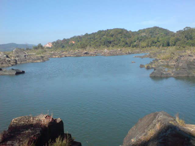
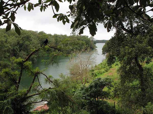
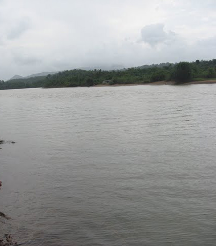
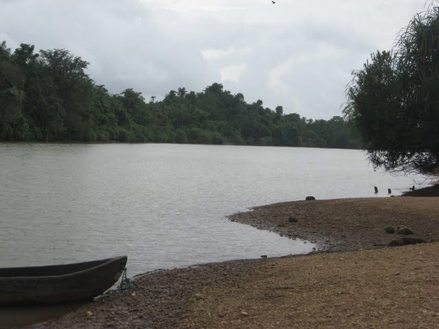
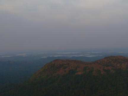
| Sharavathi is a river which originates and flows entirely within the state of Karnataka in India. It is one of the few westward flowing rivers of India and a major part of the river basin lies in the Western Ghats. The famous Jog Falls are formed by this river. The river itself and the region around it are rich in biodiversity and are home to many rare species of flora and fauna.
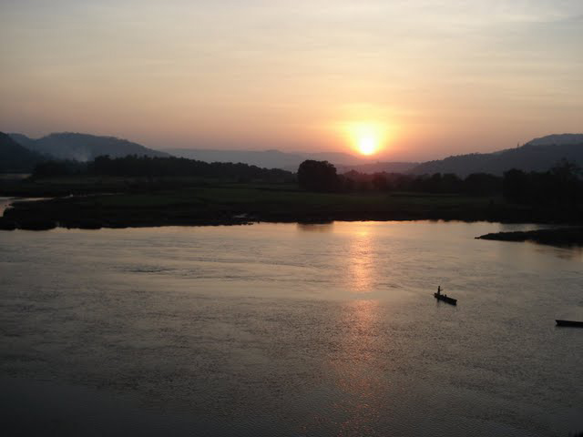
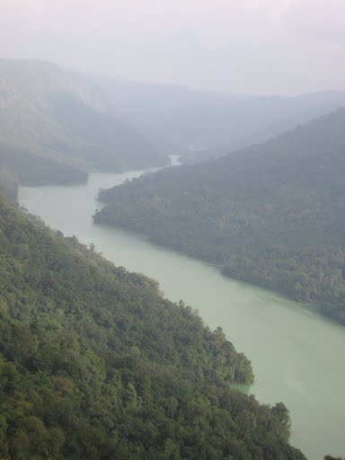
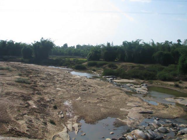
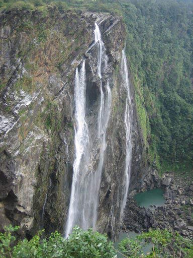
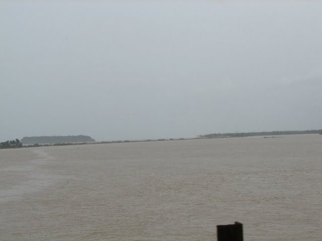
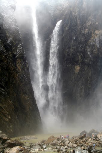
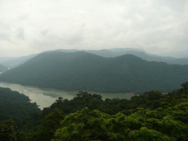
The river Sharavathi originates at a place called Ambutheertha in the Thirthahalli taluk of Shimoga district. According to a legend of the times of Ramayana, this is the place where the Hindu God Rama broke a bow to win the hand of Sita[1] The total length of the river is around 128 km and it joins the Arabian Sea at Honnavar near Uttara Kannada district. [2] On its way, the Sharavathi forms the Jog Falls where the river falls from a height of 253 mts. The river is dammed at Linganamakki and the portion of the river above the dam is upstream and the remaining is downstream. The major tributaries of the river are Nandihole, Haridravathi, Mavinahole, Hilkunji, Yennehole, Hurlihole, and Nagodihole.[2] Sharavathi river basin falls into two districts of Karnataka namely Uttara Kannada and Shimoga. The upstream river basin is extended to two taluks in Shimoga viz. Hosanagara and Sagara. The entire basin has an area of 2985.66 km2. with upstream being 1988.99 km2. and the downstream being 996.67 km2. The river basin mainly consists of Pre-Cambrian rocks. The two major groups of rocks found in the Sharavathi river basin are the Dharwar system and the peninsular gneiss. Soils in the Sharavathi basin are mainly lateritic in origin and tend to be acidic and reddish to brownish in colour. The various type of soil found here are clay loamy, clayey, clayey-skeletal, and loamy. [3] Four soil orders are found in the upstream river basin viz. ultisols, alfisols, inceptisols and entisols. |
Location info: |
| Address:The river Sharavathi originates at a place called Ambutheertha in the Thirthahalli taluk of Shimoga district. |
| District:Shimoga district |
| Nearest City:Thirthahalli taluk |
| Best time to visit: August-December is considered the season of best flow and the best time to visit. |
Climate/Weather: |
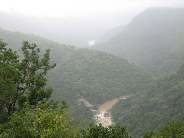
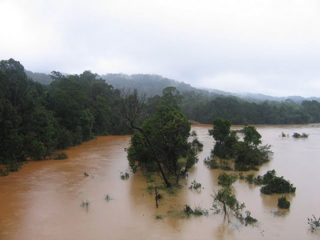
| Rainfall With a major part of the river lying in the Western Ghats, the Sharavathi river basin receives a large amount of rainfall. Mean annual rainfall ranges from 6000 mm in the western side to 1700 mm in the eastern side of the basin. About 95% of the rainfall is received during the month of June to September (July being the rainiest) when the southwest monsoon is at its peak.[2] There is some rainfall in the post monsoon season in the form of thundershowers mostly during October and some rainfall also occurs during the summer months of April and May.[2]
Temperature:-April is usually the hottest month with the mean daily maximum temperature at 35.8oC and the mean daily minimum at 22.2oC.[2] |
History: |
Interesting things to do: |
Interesting things to Visit: |
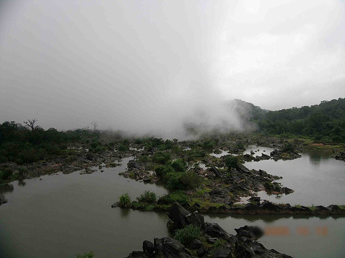
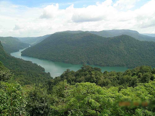
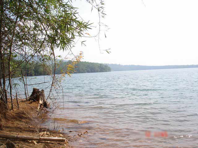
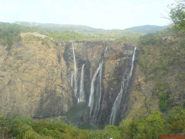
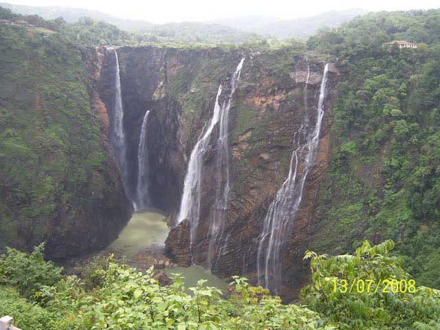
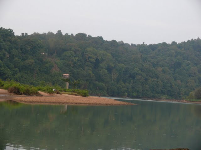
| Waterfalls :- Jog Falls:- Jog Falls is the 11th highest waterfall in India.[5] The Sharavathi river plunges 253 metres into a deep gorge here in four different segments called as Raja, Roarer, Rocket and Rani. The volume of water that reaches Jog Falls is controlled upstream by the Linganamakki dam and the falls are at their mightiest when water is released from the dam. Flora and fauna:- The Sharavathi river basin is rich in biodiversity. In a survey conducted in the basin, 23 amphibians belonging to the families of Bufonidae, Ichthyophiidae, Microhylidae, Ranidae and Rhacophoridae were recorded. Out of these 23 amphibians, 15 species are endemic to the Western Ghats. The river lends its name to the following species of fish that have been discovered in its waters: * Batasio sharavatiensis: A bagrid catfish discovered near Jog Falls, Uttara Kannada district. Sharavathi Valley Wildlife Sanctuary:- A part of the Sharavathi river basin was declared as a wildlife sanctuary on 20 April 1972.[8] Spread over an area of 431.23 km2., it has dense evergreen and semi-evergreen forests. Linganamakki reservoir spread over an area of 128.7 km2. is a part of this sanctuary. The remaining area has been divided into core zone (74.33 km2.), buffer zone (170.67 km2) and tourism zone (57.53 km2.).[8] The altitude in the sanctuary varies from 94 to 1102 mts, the highest point being Devarakonda on the southern edge of the sanctuary. Temperatures range from 15° to 38 °C and mean annual rainfall is 4500 mm. Flora:- The sanctuary has mainly evergreen, semi-green and some moist deciduous forests. Trees in the evergreen forest include species such as Dipterocarpus indicus, Calophyllum tomentosum, Machilus macrantha, Caryota urens and Aporosa lindleyana. [8] In the semi-evergreen and moist deciduous forests, common species include Lagerstroemia lanceolata, Hopea parviflora, Dalbergia latifolia, Dillenia pentagyna, Careya arborea, Emblica officinalis, Randia sp., Terminalia sp. and Vitex altissima.[8] Fauna:- The sanctuary is a refuge of the endangered Lion-tailed macaque. Other mammals include tiger, leopard (black panther), wild dog, jackal, sloth bear, spotted deer, sambar, barking deer, mouse deer, wild pig, common langur, bonnet macaque, Malabar giant squirrel, giant flying squirrel, porcupine, otter and pangolin. Reptiles include king cobra, python, rat snake, crocodile and monitor lizard.[8] Some of the avian species found in the sanctuary include three species of hornbill, paradise flycatcher, racket-tailed drongo, blue-throated barbet and Indian lories and lorikeets. |
Mobile range info: |
How to reach? |
| Nearest Railway Station:Nearest Train Station - Shivamogga. One can take the train to Shivamogga from Bangalore and then can catch a bus to Jog. |
| Nearest Airport:Mangalore airport is the nearest operational airport. Another convenient airport is Bangalore. |
| Road Transport:Jog is situated 30 kilometres (19 mi) away from Sagara, and 379 kilometres (235 mi) away from Bangalore. One can reach Jog from direct buses to Jog from Bangalore. Nearest Bus Stations - Jog, Sagara. Alternative way is to take direct bus to Sagara from Bangalore and local bus from Sagara to Jog. Distance - 102 kilometres (63 mi) from Shivamogga and 30 kilometres (19 mi) from Sagara. Also 60 km (approx.) east of Honnavar, NH206 - bus can be taken from Karwar, Honnavar or Shivamogga |
Nearest Visiting places: |
| Ramachandrapura Math:- Ramachandrapura Math is a Hindu religious institution located on the banks of the river Sharavathi in the town of Hosanagara in Shimoga district. One of the goals of this institution is the protection of Indian breed cattle (Bos indicus). A World Cattle Conference was organised by this institution in the year 2007 to promote propagation and improvement of Indian breeds of cattle.
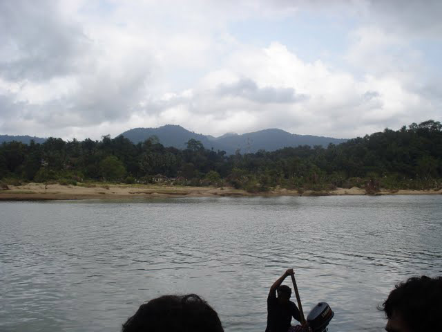
Honnemaradu:- Honnemaradu is an island on the reservoir formed by the Linganamakki dam. It is located in the Sagara taluk of Shimoga district. This place is good for watersports and hence attracts its enthusiasts. Some of the water sports possible here are canoeing, kayaking and wind surfing. Bird-watching enthusiasts also visit this place |
Nearest Petrol Pump: |
| Thirthahalli |
Hotels/Lodge/Accommodation: |
Things to carry: |
Tips & Suggestions: |
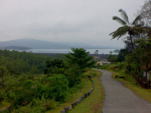
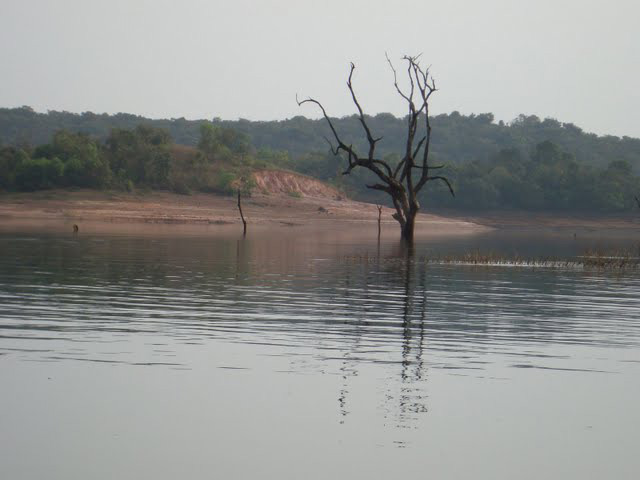
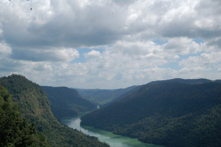
| Dams:- Linganamakki dam :- The Linganamakki dam across Sharavathi Main article: Linganamakki dam The Linganamakki dam located in the Sagara taluk has a length of 2.4 km and was constructed across the Sharavathi river in the year 1964. It was designed to impound 4368 million cubic meter of water in an area of around 300 km2, submerging 50.62 km2 of wetland and 7 km2 of dry land, the remaining being forest land and wasteland.[2] The dam's height is 1819 feet above sea level. The total capacity of the reservoir is 152 TMC (Thousand Million Cubicfeet). It has a catchment area of nearly 1991.71 km2. It receives water mainly from rainfall and also from the Chakra and Savahaklu reservoirs, which are linked through Linganamakki through a canal. The water from Linganamakki dam flows to Talakalale Balancing Reservoir through a trapezoidal canal with a discharge capacity of 175.56 cumecs. The length of this channel is about 4318.40 m with a submersion of 7.77 km2. It has a catchment area of about 46.60 km2. The gross capacity of the reservoir is 129.60 cu meters. [4] Gerusoppa dam:- The Gerusoppa dam project was completed in the year 2002 with the main purpose of generation of electricity. It was constructed near the Gerusoppa village in the Uttara Kannada district. It has a height of 56 metres and a length of 545 metres.
|
Help Line/Phone Number: |
| Police Station:Thirthahalli |
| Nearest Hospital:Thirthahalli |
| Society/Community Phone Number |

Sharavathi River Nearest Attraction |
| Agumbe Hillstation |
| Agumbe, a small village located in Karnataka for all those who wish to find peace with nature in the western ghats. It is known to be the wettest region in Karnataka receiving highest rainfall. The tiny village is much known for its beautiful sunset and the trek opportunities it offer.....more |
| Sharavathi Valley Wildlife Sanctuary |
| Located in Shimoga District, Sharavathi Valley Wildlife Sanctuary spans over 431 sq km. Apart from the area occupied by the Liganamakki Reservoir or Honnemaradu, the sanctuary is divided into core zone, buffer zone and tourism zone.....more |
| Shettihalli Wildlife Sanctuary |
| Shettihalli Wildlife Sanctuary is located in Shimoga District of Karnataka. It spreads over 395 sq km of tropical evergreen and semi-evergreen forests. The sanctuary is inhabited by tiger, leopard, wild dog, jackal, gaur, elephant, sloth bear, sambar deer, spotted deer, wild pig,....more |
| Ikkeri Archeology |
| Ikkeri is situated in Shimoga district of Karnataka state at about 3 km to the south of Sagar. The word Ikkeri in Kannada means "Two Streets". This place was the capital of Keladi Nayakas for some years....more |
| Keladi |
| Keladi is 10 km away from Ikkeri and was the Nayaka capital. You enter the precincts with its several small shrines through a long-roofed wooden entrance.....more |
| Barkana Falls |
| Barkana Falls are among the ten highest waterfalls in India. They are located near Agumbe in Shimoga district of state of Karnataka. Barkana falls are formed by Sita river. Currently Barkana falls are the prime source of one of the hydro electric projects in Karnataka.....more |
| Honnemaradu Falls |
| Honnemaradu, the village, having been engulfed in the mid-1960s by the Liganamakki dam, has been literally resurrected today. This haven for water sport enthusiasts, tucked away in the lush greenery of the Western Ghats, is in the Shimoga District in north-west Karnataka, about 25 km from Sagar town on the way to Jog Falls.....more |
| Jog WaterFalls |
| The tallest and no doubt the most impressive waterfall in India, the Jog Falls(also known as the Gerusoppa waterfalls) is located about 400 kms from Bangalore in Karnataka. It is created by the Sharavathi River which comes down in cascades from a height of 292 meters at Gerusoppa in four distinct falls, called the Raja, Rani, Rover and Rocket.....more |
| Kunchikal Falls |
| Kunchikal Falls are the highest waterfalls in India and second highest waterfalls in Asia. They are located near Agumbe in Shimoga district of state of Karnataka. Kumchikal falls are formed by Varahi river. Currently Kunchikal falls are the prime source of one of the hydro electric projects in Karnataka.....more |
| Dandavathi River |
| Dandavathi is a river that flows in Sorab, India. It originates near Kuppe (Sorab taluk) and ends in the Varada river near Sagar. Sorab's Sri Ranganatha temple is built on the bay of the Dandavathi river.....more |
| Varada river |
| Varada River, the only source of water for the Sagar town, is the major river of Shimoga District. Sagar is an industrial town in the heart of the Western Ghats, Sagar is located in Shimoga District of Karnataka. It is 75 km north-west of Shimoga.....more |
| Varahi River |
| Varahi River is a river flowing through Western Ghats to Basrur, Kundapur and Gungulli in western India. Varahi is a west flowing river which takes its birth in the Western Ghats at Hebbagilu, near Agumbe in Shimoga District.....more |
| Gudavi Bird Sanctuary |
| Sorab taluk of Shimoga district, comes alive in June as the energetic chirping of birds fills the air. The tree-lined banks of the Gudavi Lake become a brilliant mosaic of colours, with branches buried under bright plumage.....more |
| Mandagadde Bird Sanctuary |
| The Mandagadde Bird Sanctuary is situated in the Malenaadu region under the Shimoga district, towards Theerthahalli in Karnataka. The Mandagadde Bird Sanctuary has a spectacular collection of migratory birds.....more |
| Gajanur Dam |
| Gajanur is a village 12 km from Shivamogga in the Shivamogga District of Karnataka, India. The Tunga River flows through the village. Gajanur is well known for the dam built across the river.....more |
| Linganamakki dam |
| The Linganamakki dam was constructed by the Karnataka State Government in 1964. Located in the Sagara taluk, the dam has a length of 2.4 km, stretching across the Sharavathi river. It is located about 6 km from Jog Falls....more |
| Tunga Anicut Dam |
| Situiated 15 km from Shimoga, this dam was built across the river Tungabadra. You can enjoy boat trips around the lake. Situated around 15 Km from Shimoga, Tunga Anicut Dam is a popular choice for picnic among the locales.....more |
| Nagar |
| ....more |
| Humbucha |
| ....more |
SELECT YOUR HOLIDAY DESTINATION
-
Aero Sports in Karnataka
-
Archaeology in Karnataka
-
Beaches in Karnataka
-
Bird Sanctuaries in Karnataka
-
Bouldering Spot in Karnataka
-
Camping in Karnataka
-
Cave Explorations in Karnataka
-
Culturals Place in Karnataka
-
Dams in Karnataka
-
Districts Of Karnataka
-
Fairs in Karnataka
-
Festivals in Karnataka
-
Go-Karting in Karnataka
-
Hill Stations in Karnataka
-
Historical Places in Karnataka
-
Holiday Resorts in Karnataka
-
Islands in Karnataka
-
Landscape in Karnataka
-
Mountain Biking in Karnataka
-
National Parks in Karnataka
-
Orbit Network
-
Pilgrims Destinations
-
Para-sailing in Karnataka
-
River rafting in Karnataka
-
Rivers in Karnataka
-
Rock Climbing in Karnataka
-
Safari in Karnataka
-
Temples in Karnataka
-
Trekking in Karnataka
-
Water Sports in Karnataka
-
Waterfalls in Karnataka
-
Wildlife Sanctuaries in Karnataka


